
HxGN LIVE, Hexagon’s annual international conference and exhibition, goes global
HxGN LIVE, Hexagon’s annual international conference and exhibition, goes global in 2015 with two locations- 1 – 4 June in Las Vegas and 18-20 November in Hong Kong – featuring the Hexagon Geosystems Track.
Customers, partners and the global brand network of Hexagon will all come together to shape the way we work and live. This premiere conference highlights the latest trends in information, measurement and visualisation technologies fostering discussion, ideas and solutions toward creating a better and smarter world.
[rev_slider ARconferencedublin]
 In Las Vegas, enjoy four exciting days packed with exclusive technology previews, a showcase of best practices, motivating keynotes, top-notch social events, unlimited networking and much more. Then travel across the globe to experience one conference in two locations as HxGN LIVE offers a double dose of inspiring presentations, engaging trainings and must-see technologies for the first time in Hong Kong.
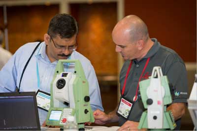
The Hexagon Geosystems Track, starring solutions and products from Leica Geosystems, Z/I Imaging, Aibotix and other brands of the Hexagon Geosystems family, will feature more than 100 presentations incorporating compelling user testimonials, reports on industry trends, new technology previews, interactive technical demonstrations, training classes and special networking opportunities.
The Geosystems track is conveniently organised into four sub-tracks:
- Surveying & Infrastructure
With an extensive portfolio of solutions for surveying and infrastructure projects, customers will learn about the latest product developments and attend innovative presentations made by professionals using Leica Geosystems solutions. Hands-on training will be available using total stations, MultiStation and GNSS and experts involved in product development and fellow users will be available for discussion. - HDS/3D Laser Scanning
High Definition Surveying and 3D laser scanning by Leica Geosystems provides optimal workflows for converting point clouds of reality into final client deliverables. Measurement professionals and recipients and users of accurate spatial information alike benefit. Civil engineers, plant designers, CAD professionals, architects, contractors, forensic investigators, archaeologists, and owner/operators can all profit from cost savings and added-value. Customers will experience demonstrations with Scan Stations and much more.
- Geospatial Solutions
The market leader in geospatial mapping technology will showcase new developments and unique applications across the world’s most comprehensive portfolio of airborne, UAV and mobile mapping solutions. Complete workflows from sensors to solutions demonstrate state-of-the-art technologies in all steps from data capturing, post processing to information generation. Attendees will learn about the latest developments of tridicon’s automated 3D city modelling, experience UAV live demos with Aibot X6 and mobile mapping with a new Pegasus system, and see next product generation of airborne imaging sensors, topo-, shallow water and deep sea bathy LiDAR systems.
- Machine Control & Construction
Machine Control systems offer valuable material cost savings, on-site safety and high accuracy resulting in increased efficiency, higher productivity and lower fuel consumption. Customers will learn how equipment can become integrated and have seamless workflows with the latest smart iCON solutions by Leica Geosystems.
Call for Speakers
Professionals with knowledge of the above sub-tracks who would like to share their projects and experience at HxGN LIVE 2015 should send us their abstracts by 6 April 2015.
We are looking for original and thought-provoking presentations in advanced technology, user testimonials, industry trends, interactive training, dynamic demonstrations and more. Selected speakers receive a free conference registration.
Ideas of no more than 150 words in length should be submitted to the respective subtrack owners below:
Surveying and Infrastructure: Bettina Dense, bettina.dense@leica-geosystems.com
3D Laser Scanning/HDS: Geoff Jacobs, geoff.jacobs@leica-geosystems.com
Machine Control and Construction: Johan Arnberg (Acting), johan.arnberg@hexagon.com
Geospatial Solutions: Wolfgang Hesse, wolfgang.hesse@leica-geosystems.com
For more information and to register for HxGN LIVE 2015, visit http://hxgnlive.com/.
Leica Geosystems – when it has to be right
With close to 200 years of experience pioneering solutions to measure the world, Leica Geosystems products and services are trusted by professionals worldwide to help them capture, analyze, and present spatial information. Leica Geosystems is best known for its broad array of products that capture accurately, model quickly, analyse easily, and visualise and present spatial information.
Those who use Leica Geosystems products every day trust them for their dependability, the value they deliver, and the superior customer support. Based in Heerbrugg, Switzerland, Leica Geosystems is a global company with tens of thousands of customers supported by more than 3,800 employees in 46 countries and hundreds of partners located in more than 120 countries around the world. Leica Geosystems is part of Hexagon, Sweden.